Explore
Get ready to experience the Goldfields Track
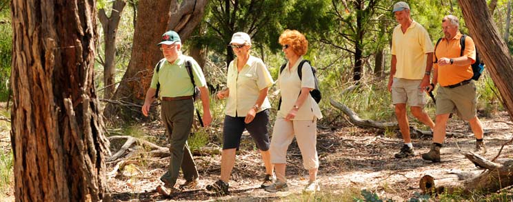
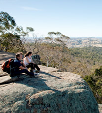
Linking the great goldfields cities of Ballarat and Bendigo, the Goldfields Track is a one of kind. It’s 210km pathway takes bushwalkers and mountain bikers through some of the most interesting and diverse scenery and Central Victoria’s treasures – from diverse forests and spectacular views to the artefacts and cultural heritage of the greatest gold rush that the world has ever seen. You’ll travel through, or very close to some of the most picturesque and hospitable villages in the state and be able to enjoy the spoils of all that they have to offer.
The track takes you from Ballarat in the south to Bendigo in the north. On the way you’ll pass through Creswick, Daylesford and Hepburn Springs, Castlemaine and Harcourt – and a number of tranquil and picturesque hamlets besides. These local villages offers a wonderful array of experiences – accommodation, restaurants, cafes, wineries, galleries, spa and speciality shopping. To find out more about each area follow the links above. Be sure to drop into a Visitor Information Centre to ask a local about their area.
The Goldfields Track is actually three interlinked tracks:
- Wallaby Track (90kms) from Mt Buninyong (20kms south of Ballarat) to Daylesford. Much of it contours what was once a productive, working forest on top of the Divide. Starting at Mt Buninyong offers some great family friendly options, otherwise, make your start the Ballarat Railway Station.
- Dry Diggings Track (60km) from Daylesford to Castlemaine, is arguably one of the best stretches of single track in the country. From wet temperate forests on top of the Great Dividing Range to the drier northern plains near Castlemaine.
- Leanganook Track (60km) from Castlemaine to Bendigo has yet more ever changing spectacular scenery. From the granite tors around Mt Alexander to the golden plains near Bendigo. Heritage abounds on this track, from gold rush relics, to the still in use engineering marvel that is the Coliban Water System.
To find out more about each track follow the links above or click through from the Explore drop down menu. Be sure to look at the map for your preferred method of travel – cycling or walking – as the routes differ slightly. You can toggle between the two options by clicking on the icons to the left of the maps.